See radioactive radon gas hotspots across the North East as interactive map gets first update in 10 years

and live on Freeview channel 276
The UK Health Security Agency (UKHSA) and the British Geological Survey (BGS) have published an updated radon potential map for Great Britain revealing the UK’s hotspots for the radioactive gas. The interactive tool allows users to zone in on where they live to find out if the area is at higher risk
Updated for the first time in 10 years last week, the map is available to view on the UK Radon website. The map is said to provide ‘an authoritative analysis of the likelihood of a building being in a radon affected area (an area with higher radon potential).’
Advertisement
Hide AdAdvertisement
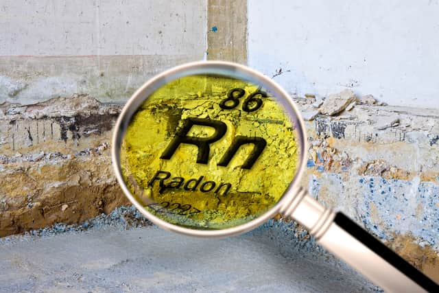
Hide AdRadon is a colourless and odourless gas and is attributed to 1,100 lung cancer deaths per year in the UK. The risk is highest among smokers and former smokers.
As you can’t see, smell or taste it, special equipment has been made to detect radon, which comes from the rocks and soil found all over the UK. The level of radon we breathe outside is low, but can be higher in some buildings.
The UKHSA said: “High levels of radon can cause lung cancer, particularly for smokers and ex-smokers. Radon produces tiny radioactive particles in the air we breathe. Radiation from these particles damages our lung tissue, and over a long period may cause lung cancer. The higher the level and the longer the period of exposure, the greater the risk will be.”
But now, the interactive map shows where levels of radon are likely to be higher. The darker the colour the greater the chance of a higher level. The chance is less than one home in a hundred in the white areas and greater than one in three in the darkest areas.

Advertisement
Hide AdAdvertisement
Hide AdIf you click on ‘explore interactive map’ you can search by town or postcode. Residents of Newcastle Upon Tyne will be relieved to know the area is reported to be at low risk. The map reveals: “All parts of this 1km grid square are in the lowest band of radon potential. Less than 1% of homes at or above the Action Level.”
Comment Guidelines
National World encourages reader discussion on our stories. User feedback, insights and back-and-forth exchanges add a rich layer of context to reporting. Please review our Community Guidelines before commenting.